If you like Organic Maps, I also recommend CoMaps, the community fork: https://www.comaps.app/
I prefer CoMaps because:
- CoMaps supports Panoramax Street Views, whereas Organic Maps doesn’t.
- CoMaps code is on Codeberg, not on Microsoft like Organic Maps.
“on microsoft” you mean github? Either way it’s opensource
GitHub is owned my Microsoft.
Cool
I personally switched to Comaps but it is good that Organic maps is an option
Good direction EU.
Also, CoMaps is an excellent alternative choice.
Wait, the title confused you. The exact changlog is:
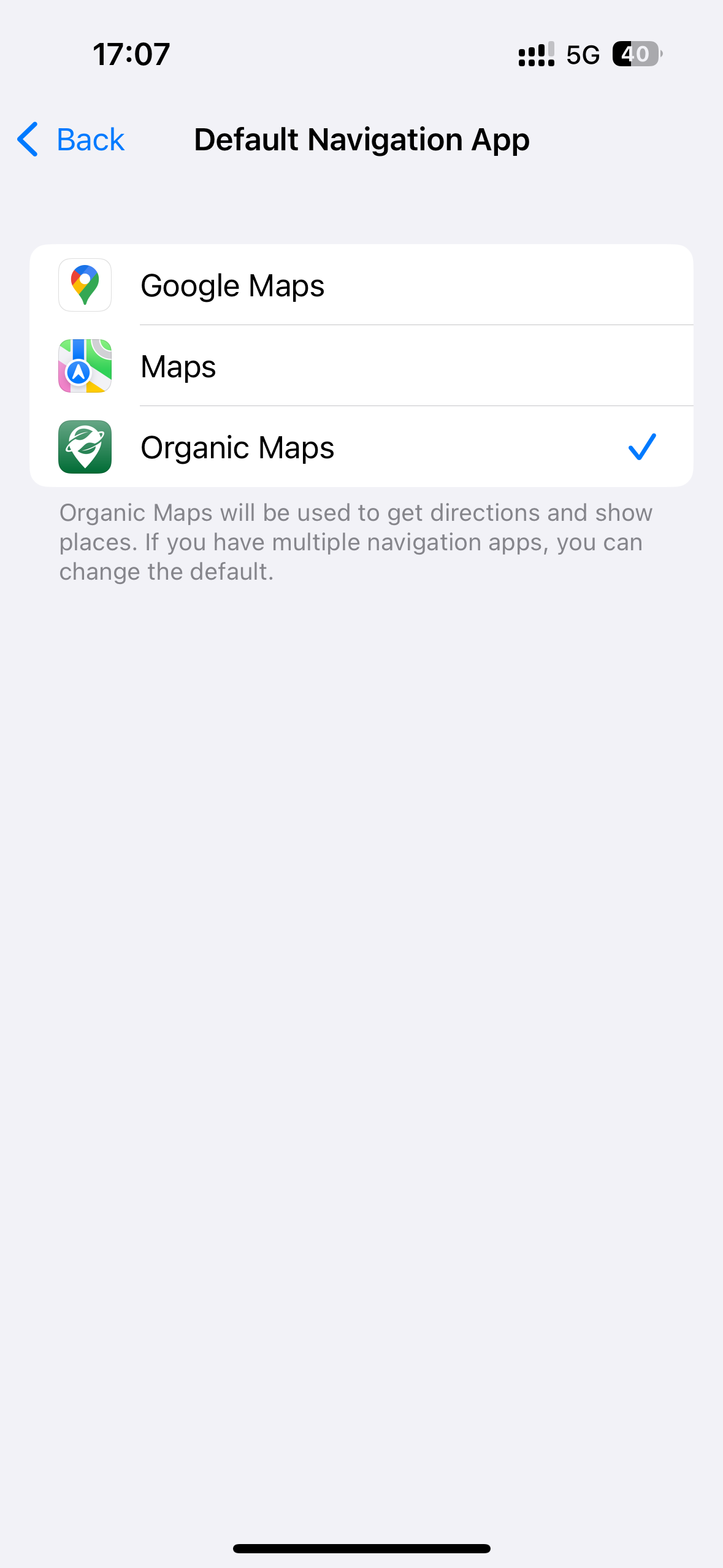
EU users can set Organic Maps as the default navigation app in iOS Settings → Apps → Default Apps → Navigation
My apologies for that I just copy-pasted the title from the original post.
What are “road shields” supposed to be? Do they mean signs?
Can be enabled as default*
You are absolutely right. I’ve edited the title from “Organic Maps as default navigation app in EU on iOS, and road shields displaying on Android” to “Organic Maps can be set as default navigation app in EU on iOS, and road shields displaying on Android”. I am sorry for late response. I was at work and couldn’t check.
Well, yesterday I visited the contributors pages on github(both of OrganicMaps and the mirror of CoMaps), I could not be sure CoMaps has an enough number of maintainers.
Does anybody has use organic maps in a daily usage? Would you recommend it?
I use it for biking/walking in my home city and really like it for that purpose.
I’m not using it when I have to take public transport (it usually gets the correct route, but doesn’t include departure times) or if I’m looking up locations in other random parts of the world, as I’d have to download that area first.
…it depends.
If you need to get to the airport and must know if a road has been recently re-routed or that traffic is clear in order to make your flight, no (unless there is a live traffic feature I have to seen yet?..)
If you’re well-being isn’t dependant on avoiding minor disruptions, then absolutely!
I absolutely use it as a daily system and contribute to the network when I notice something is missing.
It’s great for cyclists, hikers and when in a new city. It’s also good for in-car navigation, but no traffic support yet.
Google Maps has better navigation, but Comaps and OM have better management of bookmarking places. The search on Comaps often suffers, so I mainly use my bookmark list searches for stuff. I haven’t used OSand because it was so clunky and horrible right off the bat, but supposedly that is a way to access OSM bus routing. Considering how unreliable many municipal transit network apps and their Google Maps integrations are already, that’s just to be expected tho. Huge benefit is being able to more easily export that data for use in Emacs Orgmode, as with other log files, but that’s kinda complicated
Google Maps has an insane amount of resources & the time economy of FOSS devs is totally managed by nonprofit donors and/or also overlapping with larger tech employers