

Yeah but you know that even if they got it perfect, that one prick’d get on a plane or a boat or something and screw it all up
I’d love to see this done horizontally

I think she meant put the slices vertically on the horizontal map

Perfection.
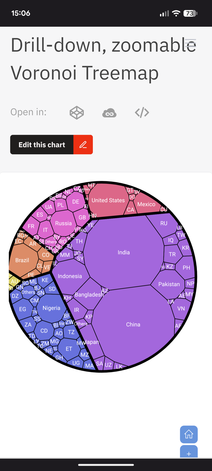
Slightly different slicing in a Voronoi diagram:
I bet you would sicko.
something close to what you mean: https://bigthink.com/strange-maps/563-pop-by-lat-and-pop-by-long
And look at that, America is THE BIGGEST!!!
Fuck yeah!
USA! USA! USA!

I don’t believe there’s a single way to arrange those zones, but instead that it becomes a consequence of some arbitrary choice of where to place the first one.
As such, I would like to see two versions of this concept: one in which the zone placement is chosen to maximize the size disparity, and another in which it’s chosen to minimize it.
Edit: now realizing that this is exactly what you were saying…
I was thinking more about this and realized that once you decide the first segment, the rest are deterministic. Because the adjacent segments cannot be larger or smaller than containing 10% of the population.
Further, once you define the east or west edge of the first segment, the other edge is also deterministic.
In theory you could calculate every possible arrangement of zones to a certain accuracy, such as to every degree of 360. There’s only as many possible combinations as there are starting positions for the first longitude you pick.
they placed the first and last zones over the pacific, in the shape of their globe projection. Seems fair.
I think any choice of initial conditions would be equally fair, but I’m still curious about how much variation there could be.
yeah was thinking this. I mean right away you would thing you would draw the first border just left of iceland to sorta divide between new/old world. But then I look and it seems like this was done but in the pacific which makes a certain amount of sense given the larger pacific ocean and the cleaner break you get. Looks like it was made to keep the us all in one chunk as it takes part of russia in order to get all the alutian islands.
I mean, occam’s razor says they just started at the international date line because that is the far left of most commonly used map projections and went left to right, I wouldn’t be too confident reading any intent into this placement
Antarctica must be fucking packed yo
I was also thinking how much Russia is piggybacking on its neighbors here
wow. Newfoundland and Labrador and Greenland have so many more density than rest of North America!
Africa’s doing a lot of the heavy lifting there.
I’m not gonna lie, I’m glad I don’t live in Asia. That population density wouldn’t do well with my anxiety
Depends on a lot of things, of course you probably wouldn’t feel great in Beijing, but the population density of China is almost half the UK’s.